A reproducible QGIS workflow for visualizing Copernicus Marine Mediterranean temperature data
DOI:
https://doi.org/10.47193/mafis.4012027010106Keywords:
QGIS, Copernicus Marine Service (CMEMS), NetCDF, sea surface temperature (SST), Mediterranean Sea, marine monitoringAbstract
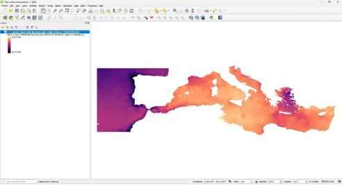
This technical document presents a reproducible geospatial workflow for ingesting, rendering, and temporally configuring multidimensional marine oceanographic data using QGIS LTR 3.44. Using the Mediterranean Sea physics numerical analysis and forecast product from the Copernicus Marine Environment Monitoring Service (CMEMS; product MEDSEA_ANALYSISFORECAST_PHY_006_013), which assimilates satellite and in-situ observations, this guide illustrates practical operational procedures within an open-source desktop environment. The demonstrated workflow covers NetCDF data loading, surface layer subsetting, range-calibrated singleband pseudocolor symbology, and dynamic temporal control configuration for time-series display across the Mediterranean Basin using an illustrative one-month dataset (August 2026). This step-by-step framework addresses software entry barriers, providing marine researchers and spatial analysts with an open-source protocol for processing multidimensional oceanographic model outputs.
Downloads
References
Concolis BMM. 2025. High-resolution reanalysis biological ocean data from the Copernicus Marine Service Information for Philippine marine research. Data Brief. 111913.
Dmytro H, Arkadii S, Tetiana A, Dmytro K, Denys Y. 2023. Advantages of using QGIS to solve spatial planning tasks. Baltic Surveying. 50.
Duarte L, Teodoro AC. 2021. GIS open-source plugins development: a 10-year bibliometric analysis on scientific literature. Geomatics. 1 (2): 206-245.
European Space Agency. 2026. Earth observation missions. https://www.esa.int/Applications/Observing_the_Earth.
Flenniken JM, Stuglik S, Iannone B. V. 2020. Quantum GIS (QGIS): an introduction to a free alternative to more costly GIS platforms: FOR359/FR428, 2/2020. Edis. (2): 7.
Le Traon PY, Reppucci A, Alvarez Fanjul E, Aouf L, Behrens A, Belmonte M, Bentamy A, Bertino L, Brando VE, et al. 2019. From observation to information and users: The Copernicus Marine Service perspective. Front Mar Sci. 6, 234. DOI: https://doi.org/10.3389/fmars.2019.00234
Okladnikov IG, Gordov EP, Titov A. G. 2016. Development of climate data storage and processing model. In: IOP Conference Series: Earth and Environmental Science. IOP Publishing. 48 (1): 012030.
Petrosillo I, Scardia AMS, Ungaro N, Specchiulli A, Fanelli G, Centoducati G, De Serio F, Carlucci R, Valente D, Barbone E, et al. 2023. Towards sustainable marine spatial planning of aquaculture. Ecol Indic. 154: 110542. DOI: https://doi.org/10.1016/j.ecolind.2023.110542
Pisano A, Marullo S, Artale V, Falcini F, Yang C, Leonelli FE, Santoleri R, Buongiorno Nardelli B. 2020. New evidence of Mediterranean climate change and variability from sea surface temperature observations. Remote Sens. 12 (1): 132. DOI: https://doi.org/10.3390/rs12010132
Rosas-Chavoya M, Gallardo-Salazar JL, López-Serrano PM, Alcántara-Concepción PC, León-Miranda AK. 2022. QGIS a constantly growing free and open-source geospatial software contributing to scientific development. Cuad Investig Geogr. 48 (1): 197-213.
Semeraro T, Luvisi A, Lillo AO, Aretano R, Buccolieri R, Marwan N. 2020. Recurrence analysis of vegetation indices for highlighting the ecosystem response to drought events: an application to the Amazon forest. Remote Sens. 12 (6): 907.
Tiralongo F, Lillo AO, Tibullo D, Tondo E, Martire CL, D’Agnese R, Macali A, Mancini E, Giovos I, Coco S, et al. 2019. Monitoring uncommon and non-indigenous fishes in Italian waters: one year of results for the AlienFish project. Reg Stud Mar Sci. 28: 100606. DOI: https://doi.org/10.1016/j.rsma.2019.100606
Von Schuckmann K, Le Traon PY, Alvarez-Fanjul E, Axell L, Balmaseda M, Breivik LA, Brewin RJW, Bricaud C, Drevilon M, Drillet Y, et al. 2016. The Copernicus marine environment monitoring service ocean state report. J Oper Oceanogr. 9 (2): 235-320. DOI: https://dx.doi.org/10.1080/1755876X.2016.1273446
Von Schuckmann K, Le Traon PY, Smith N, Pascual A, Djavidnia S, Gattuso JP, Grégoire M, Nolan G. 2019. Copernicus Marine Service Ocean State Report, Issue 3. J Oper Oceanogr. 12 (1): 1-123. DOI: https://doi.org/10.1080/1755876X.2019.1633075
Published
Issue
Section
License
Copyright (c) 2026 Antonio O. Lillo

This work is licensed under a Creative Commons Attribution-NonCommercial-ShareAlike 4.0 International License.
Authors of articles published in Marine and Fishery Sciences retain copyright on their articles, except for any third-party images and other materials added by Marine and Fishery Sciences, which are subject to copyright of their respective owners. Authors are therefore free to disseminate and re-publish their articles, subject to any requirements of third-party copyright owners and subject to the original publication being fully cited. Visitors may also download and forward articles subject to the citation requirements. The ability to copy, download, forward or otherwise distribute any materials is always subject to any copyright notices displayed. Copyright notices must be displayed prominently and may not be obliterated, deleted or hidden, totally or partially.
This journal offers authors an Open Access policy. Users are allowed to read, download, copy, distribute, print, search, or link to the full texts of the articles, or use them for any other legal purpose within the Creative Commons 4.0 license (BY-NC-SA), without asking prior permission from the publisher or the author. This is in accordance with the BOAI definition of Open Access.